
NASA ISRO radar satellite beams first Earth images from space
NASA ISRO radar satellite beams first Earth images from spaceby Clarence OxfordLos Angeles CA (SPX) Sep 26, 2025Preliminary radar images from the NASA-ISRO Synthetic Aperture Radar (NISAR) mission reveal the extraordinary capabilities of the most advanced Earth-observing radar satellite ever launched. The spacecraft, developed through a long-standing U.S.-India partnership, is now preparing for full science operations later this year.
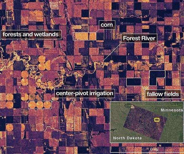
Launched by ISRO on July 30, NISAR is designed to provide unprecedented insights into natural hazards, agriculture, and climate change. Its first L-band synthetic aperture radar images, released in August, captured detailed views of Mount Desert Island in Maine and agricultural regions of North Dakota. Waterways, forests, farmland, and human structures were all distinctly visible, underscoring the system's ability to differentiate between land cover types.
"The successful capture of these first images from NISAR is a remarkable example...