
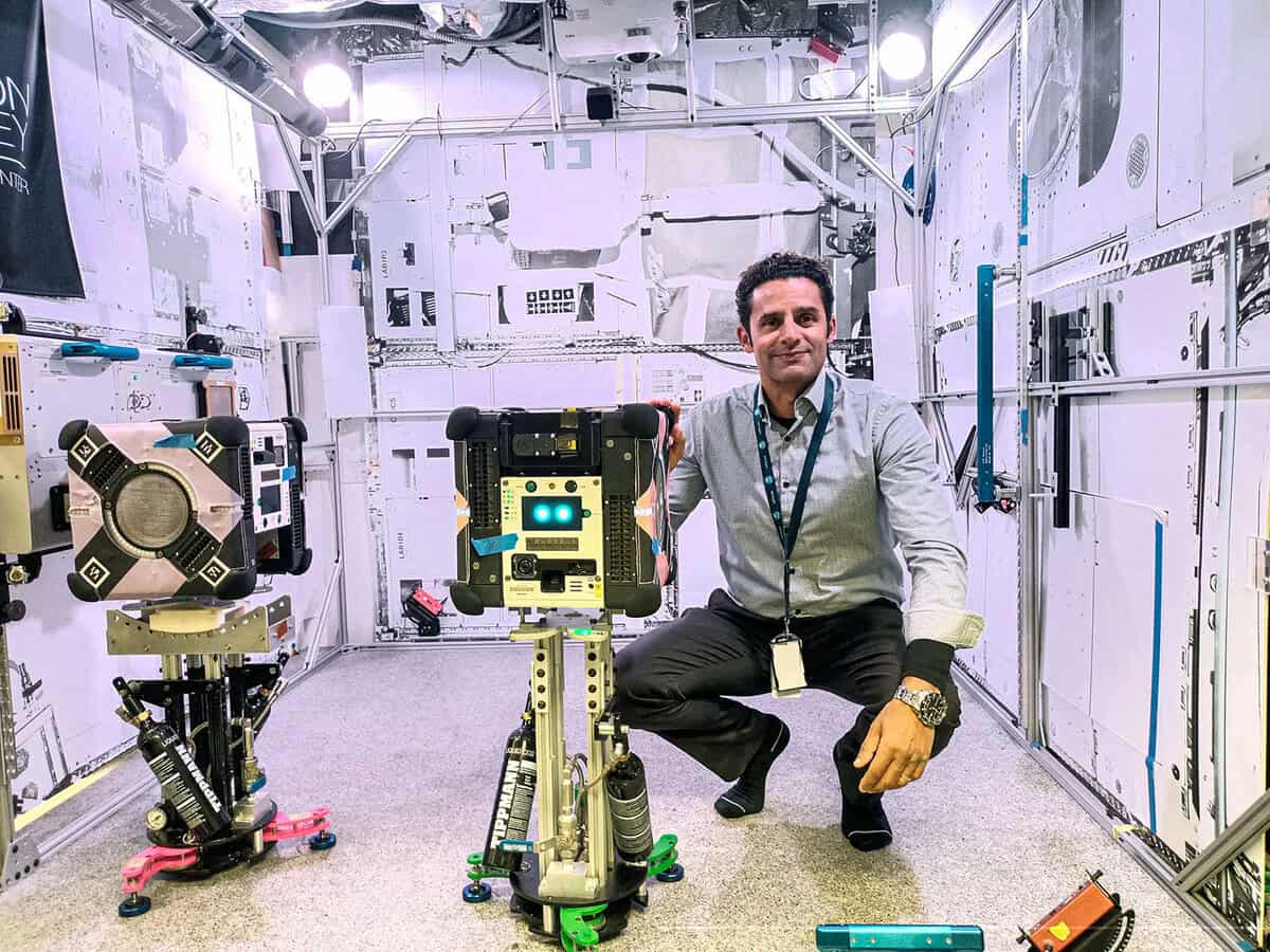
Exploring the vastness of space presents unique challenges, especially when navigating uncharted celestial environments without the aid of familiar tools like GPS. Contemporary 3D mapping technology is emerging as a critical solution to these challenges, offering precise spatial awareness and autonomous navigation capabilities. Notably, NASA’s Multi-Resolution Scanner (MRS), deployed aboard the International Space Station’s (ISS) free-flying robotic Astrobee, exemplifies this technological breakthrough. This article delves into how such innovative 3D mapping systems might transform space exploration by enhancing navigation accuracy, supporting robotic autonomy, and enabling detailed environmental analysis on the Moon, Mars, and beyond.
The Challenges of Navigating in Space
Navigating in space is inherently complex due to the absence of traditional positioning systems like GPS, which are Earth-centric. Astronauts and robotic explorers must rely on alternative methods to understand their environment and traverse unfamiliar terrain safely. The vastness and unpredictability of space environments, such as lunar surfaces or Martian landscapes, further exacerbate these difficulties.
Without precise location data, astronauts and robotic systems face increased risks of disorientation, inefficient route planning, and potential mission hazards. Uncharted territories lack reliable maps, making exploration slower and more dangerous. This challenge highlights the urgent need for advanced mapping technologies capable of providing detailed, real-time spatial information.
Moreover, the microgravity conditions aboard space stations and other celestial bodies introduce additional complexity to navigation and mapping. Traditional terrestrial techniques often fall short in these environments, necessitating innovative approaches that can operate effectively in zero or low gravity.
Introducing NASA’s Multi-Resolution Scanner (MRS)
The Multi-Resolution Scanner (MRS) represents a cutting-edge 3D mapping system designed to address space navigation challenges. Developed in collaboration between NASA, Boeing, and the Commonwealth Scientific and Industrial Research Organisation (CSIRO) of Australia, MRS leverages multiple sensor technologies to generate detailed three-dimensional maps of complex environments.
MRS operates aboard NASA’s free-flying Astrobee robots on the ISS, enabling autonomous scanning of modules such as Kibo. The scanner integrates data from diverse sensors, compensating for individual limitations to produce high-resolution 3D models coupled with precise trajectory information. This multi-sensor fusion enhances mapping accuracy critical for autonomous navigation.
By validating MRS in the microgravity environment of the ISS, researchers gain valuable insights into its performance under real space conditions. This testing phase is essential to ensure the technology’s readiness for deployment in more challenging and remote extraterrestrial settings like the Moon or Mars.
How 3D Mapping Enhances Autonomous Navigation
Autonomous navigation is vital for robotic explorers tasked with surveying hazardous or inaccessible regions of space. Contemporary 3D mapping technologies provide the spatial awareness required for robots to localize themselves and plan optimal movement paths without human intervention.
MRS and similar systems utilize simultaneous localization and mapping (SLAM) algorithms, which allow robots to build and update maps of unknown environments while tracking their own position within those maps. This capability is indispensable in the absence of GPS or external positioning aids.
High-resolution 3D data enables robots to identify obstacles, analyze terrain features, and make real-time decisions to avoid hazards. This autonomy reduces reliance on remote control, lowers operational latency, and increases mission efficiency and safety.
Applications Beyond the International Space Station
While initial tests of MRS focus on the ISS, the technology holds significant promise for broader space exploration missions. Potential applications include mapping lunar lava tubes, Martian caves, and other complex terrains where traditional exploration methods are limited or risky.
Future lunar and Martian habitats, such as NASA’s planned lunar Gateway, may rely heavily on robotic systems equipped with advanced 3D mapping to maintain operations autonomously when human presence is minimal or absent. This capability is crucial for long-duration missions or remote outposts.
Moreover, detailed environmental maps generated by MRS can guide scientific investigations, resource identification, and habitat construction, facilitating more informed decision-making and mission planning on extraterrestrial surfaces.
Collaborative Efforts Driving Innovation
The development of MRS exemplifies the power of international and interdisciplinary collaboration. NASA, Boeing, and CSIRO combine expertise in aerospace engineering, robotics, and scientific research to advance space mapping technologies.
CSIRO’s involvement, including leveraging assets like the Parkes radio telescope, highlights the integration of Earth-based scientific infrastructure to support and enhance space missions. This synergy accelerates technology maturation and operational readiness.
Such collaborations not only propel space exploration capabilities but also foster knowledge exchange that benefits terrestrial industries, including mining, environmental monitoring, and autonomous vehicle development.
The Role of Robotics in Future Space Missions
Robotic explorers equipped with 3D mapping systems are poised to become indispensable for future space missions. They can operate continuously in environments too dangerous or inaccessible for humans, performing reconnaissance, maintenance, and scientific tasks autonomously.
NASA’s Astrobee robots demonstrate how free-flying robotic assistants can navigate confined spaces like the ISS using advanced mapping data. Scaling this technology to planetary surfaces will enable more complex mission profiles and reduce human risk.
As space agencies plan for sustained lunar and Martian presence, robotic systems with sophisticated navigation and mapping will be critical to mission success, ensuring operational continuity and enhancing human-robot collaboration.
Implications for Earth and Beyond
Beyond space, contemporary 3D mapping technologies have transformative potential for Earth-based applications. High-resolution spatial data supports industries such as construction, agriculture, disaster response, and autonomous transport, improving efficiency and safety.
The lessons learned from deploying MRS and similar systems in extreme environments inform the development of robust, adaptable mapping solutions suitable for diverse terrestrial challenges. This cross-pollination accelerates innovation across sectors.
Ultimately, advancements in 3D mapping technology driven by space exploration will contribute to a more connected, informed, and autonomous future both on Earth and in the cosmos.
Conclusion
The advent of contemporary 3D mapping technologies like NASA’s Multi-Resolution Scanner marks a pivotal moment in space exploration. By enabling precise, autonomous navigation in environments devoid of GPS, these innovations unlock new possibilities for robotic and human missions alike. As testing aboard the ISS validates these systems, their potential to support lunar, Martian, and deep-space endeavors becomes increasingly tangible. Furthermore, the collaborative efforts driving these advancements underscore the global commitment to exploring and understanding space. Beyond the cosmos, the ripple effects of this technology promise to enhance terrestrial industries, demonstrating that the quest to map the unknown ultimately benefits all of humanity.