Blog
How WWI got Nat Geo got into the map business
Business
But thousands of miles away, a group of committed National Geographic cartographers had different marching orders: Don’t change the map of Europe until the war is over. Leaving borders in place would show what was at stake.
The National Geographic Society had been making maps since the First World War. National Geographic Society president Gilbert Grosvenor had not only anticipated the conflict, but also knew that National Geographic readers would need maps to understand it. Dissatisfied with the first map he commissioned from an outside company, Grosvenor established a map department within the Society in 1915.
Nat Geo was now in the map business—and the inclusion of maps in its magazine piqued readers’ interest.
The first map produced in-house, 1918’s “Map of the Western Theatre of War,” was the most comprehensive of its kind—and set the stage for decades of mapmaking to come. These maps would later be gifted to heads of state who needed detailed maps of territories in Europe and the Pacific.
“In addition to how valuable the military found the Society’s maps, I think that Society members must have studied these maps in a way that is a bit difficult for us to appreciate today,” says National Geographic Society senior archivist Cathy Hunter. She sees the maps as more than dry listings of boundaries and place names. “So many would have known someone who was serving overseas in places that Americans had never heard of.”
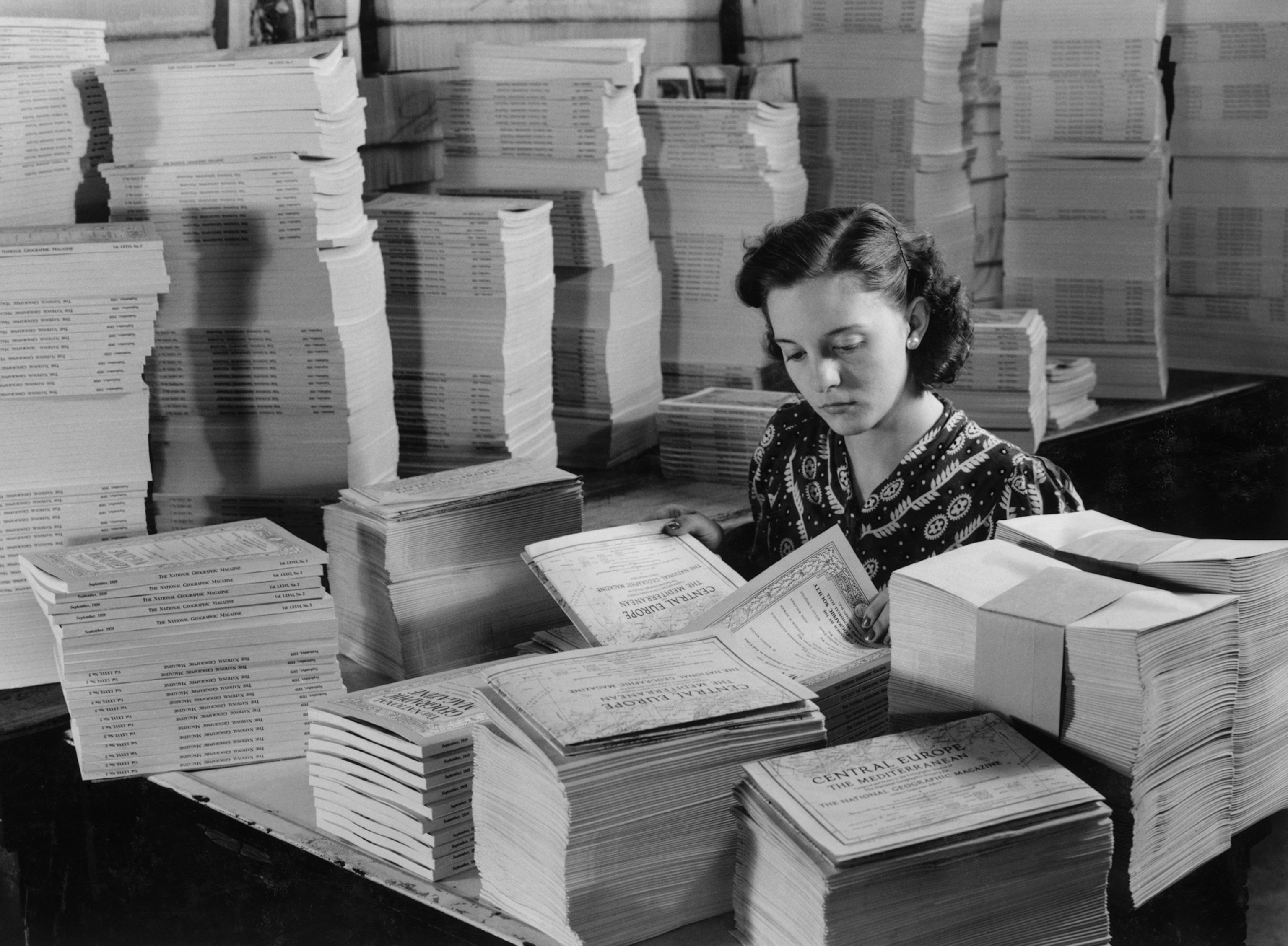
A million and a quarter map supplements for one month of National Geographic magazines are folded by machine and then inserted by hand. This is the map of Central Europe and the Mediterranean, which reached members immediately after the outbreak of the war.
Photograph by Paul Pryor, National Geographic Image Collection
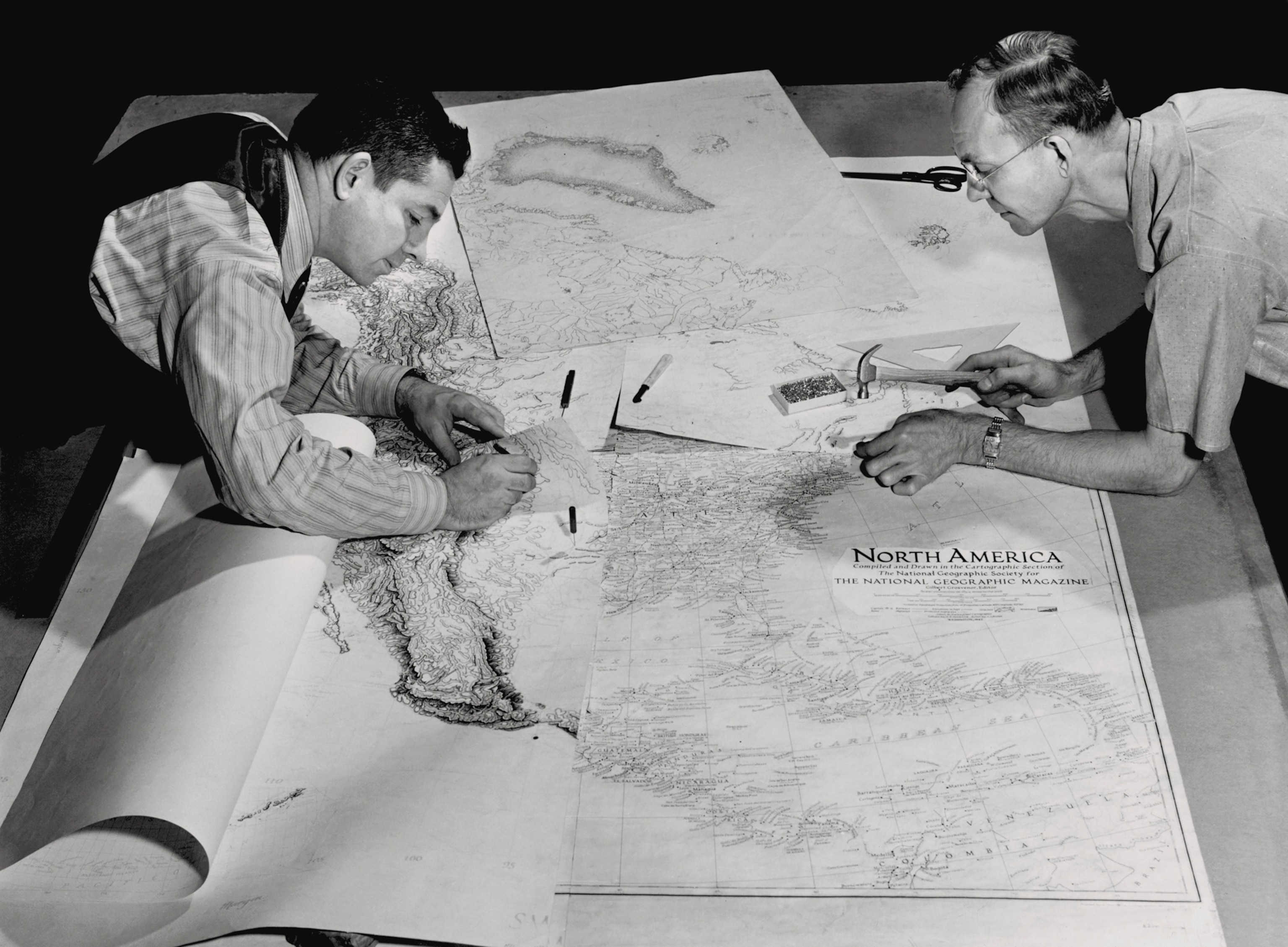
One sheet (lower right) shows parallels, meridians, place names, railroads, and other works of man on the continent. Another shows relief by myriad tiny pen strokes—450 hours of work. A third shows drainages; a fourth the roads. Drawings are made in sections so several experts can work on them at once.
Photograph by B. Anthony Stewart, National Geographic Image Collection
Business Mapping World War II
By the time Nazi troops invaded Poland in 1939, National Geographic was internationally known for its maps. Chief cartographer Albert H. Bumstead, who had honed his mapmaking skills as an employee of the U.S. Geological Survey, had helped push the Society to the forefront of the international mapmaking trade thanks to inventive new mapping techniques.
LIMITED TIME: 50% OFF
Big savings, bigger adventures. Subscriptions are starting at $17/year.
When Bumstead died in 1940 at age 64, he was succeeded by James Darley, who continued pushing National Geographic cartographers to produce the most accurate, innovative maps possible.
They had a leg up on federal cartographers, explains Garrett Dash Nelson, president and head curator of the Leventhal Map and Education Center at the Boston Public Library.
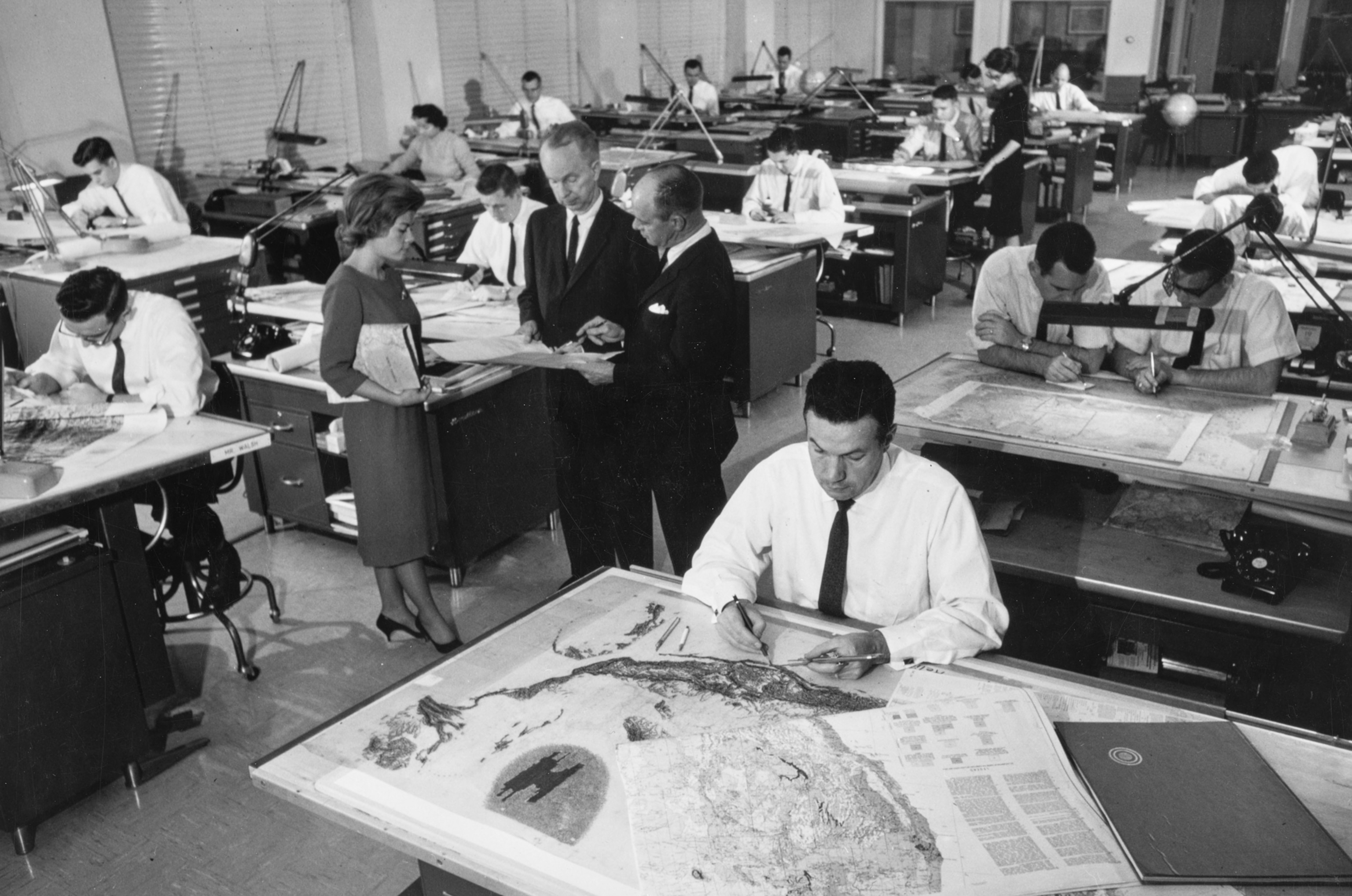
Employees of the Cartographic Division at work. Standing are: Carol J. Cunningham, James M. Darley (left), and Wellman Chamberlin.
Photograph by B. Anthony Stewart, National Geographic Image Collection
“Through the 1930s, the most important surveying and mapmaking efforts conducted by the U.S. federal government were primarily oriented towards the nation’s own territory, in programs like the U.S. Geological Survey and the Coast & Geodetic Survey,” he says. As a result, federal agencies, and Society members, turned to National Geographic for help with maps once the U.S. entered the war.
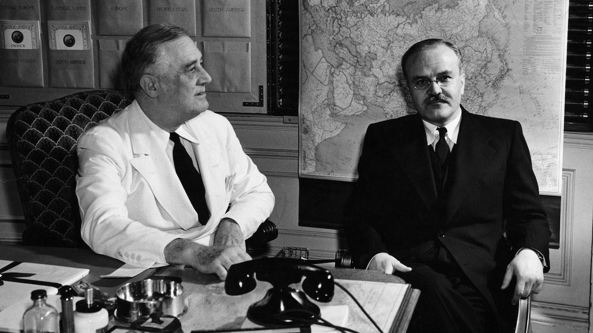
Shortly after the surprise attack at Pearl Harbor, White House officials asked the Society to provide President Roosevelt with maps that could help him understand the location of various remote Pacific islands not shown on their maps.
Darley was happy to oblige—and less than a week later, Grosvenor gifted the president with a handmade map cabinet designed and built by Society workers.
Business You May Also Like
Made of mahogany, the inventive cabinet could hold multiple rolled-up maps that the president and his advisers could easily consult thanks to window-blind-like rollers. Even better, the maps were regularly updated by Nat Geo cartographers, who were constantly on the hunt for new ways to produce the world’s most accurate, detailed, and readable maps.
The National Geographic Society went on to produce map cabinets for other wartime luminaries such as British prime minister Winston Churchill—a gift commissioned by FDR himself. The president’s map cabinet helped spur the creation of the White House’s wartime Map Room, a situation room-like office that served as the nerve center of the Allied effort to defeat Nazi Germany, fascist Italy and Imperial Japan.
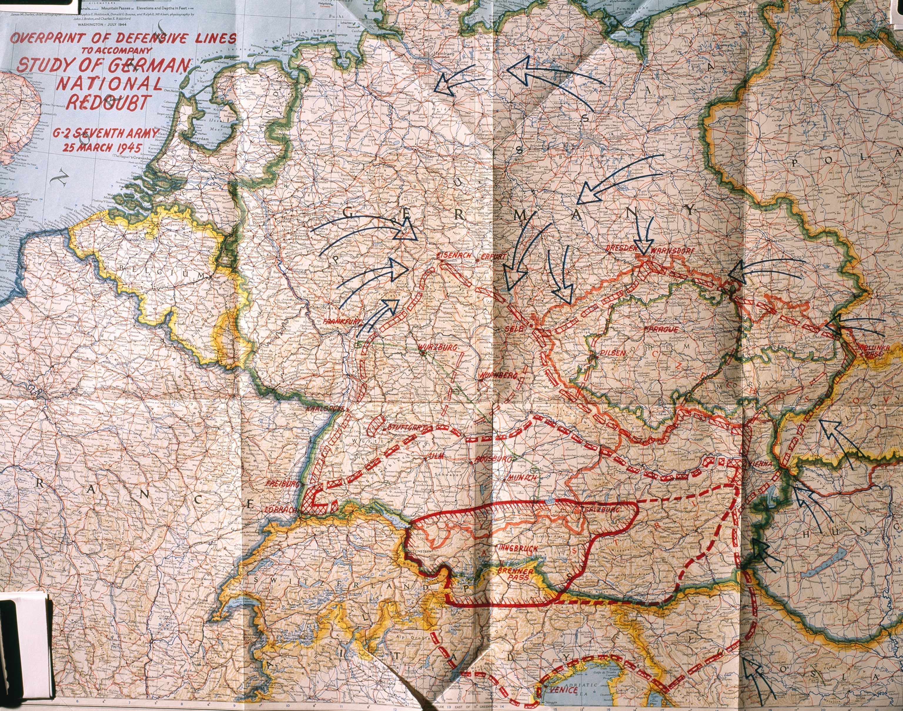
This July 1944 magazine supplement entitled “Germany and Its Approaches” was used by the Supreme Headquarters Allied Expeditionary Forces during World War II to map enemy troops and to plot Allied responses. This marked copy of the map was dated March 25, 1945, and thousands were duplicated and posted throughout Europe to aid Allied convoys as they passed through even the most remote villages. The map is kept in our National Archives.
Photograph by Sisse Brimberg, National Geographic Image Collection
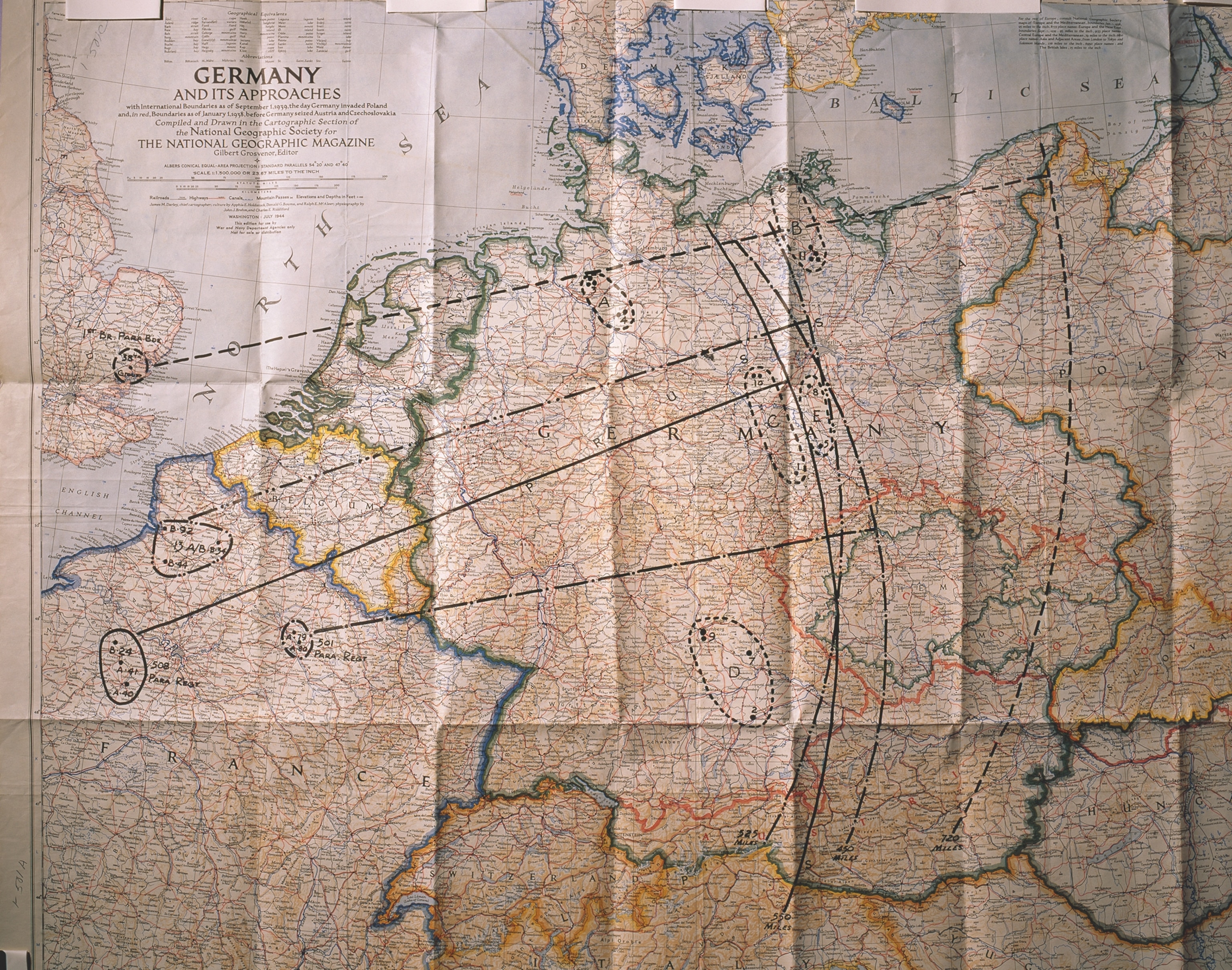
Another section of “Germany and Its Approaches” showing planning for “Operation Jubilant”. Although never executed, the plan was devised to enable paratroopers to free Allied prisoners of war during World War II. This map is now housed in the National Archives.
Photograph by Sisse Brimberg, National Geographic Image Collection
Business “Germany and its approaches”
Though the Society produced multiple maps during the war, the most influential was “Germany and its Approaches,” which provided a detailed look at the end goal of the Allies’ painful, pincer-like progress toward the heart of Nazi Germany. Published just weeks after D-Day, the July 1944 map helped those at home track the movements of the Allies with unprecedented insight into not just place names, but the locations of key waterways, railroads, and roads.
To prevent confusion, the cartographers kept country boundaries frozen at where they had stood before the war began.
“Coupled with new technology like radio communications, aerospace engineering, and early computers, the increasing accuracy and availability of geographic information now allowed the United States to project power around the globe,” says Nelson. “Americans also began to familiarize themselves in popular culture and public education with world geography and the United States’s position on a world stage.”
Meanwhile, “Germany and its Approaches” became an important battlefield tool.
The U.S. Army Corps of Engineers posted 20,000 enlarged copies of the map at critical road junctions to help drivers get crucial supplies and medical help to the front lines. The map was distributed to British and American officers in the field. It was even used by the Allies to map out their proposed occupation of Germany and the fate of its neighbors—a blueprint that would set the stage for the postwar period, the Cold War, and Europe’s recovery.
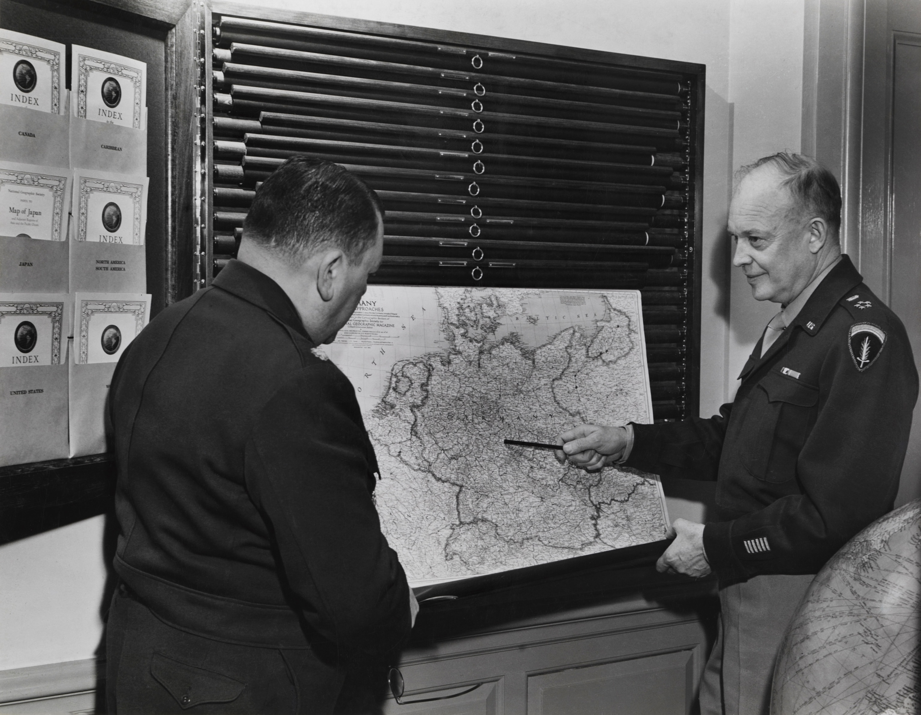
Dwight Eisenhower points to a map of Germany held in a special map rack. National Geographic created specially made map cabinets for heads of state such as Franklin D. Roosevelt and Winston Churchill.
Photograph by B. Anthony Stewart, National Geographic Image Collection
Business A lasting impression
Estimates of the reach of Society maps vary: According to its own records, National Geographic sent over 540,000 paper and 21,000 linen maps to the War Department alone between 1939 and 1945, with thousands more headed to government agencies like the Office of Emergency Management and the Office of Strategic Services (OSS), the forerunner of the modern CIA. And the Society’s 1.5 million members received four full-color maps each year.
Over time, National Geographic maps became repositories for the hopes, fears, and resolutions of a world determined to beat back tyranny—and a way to better understand the once foreign places that determined the course of the world’s largest war.